St. Croix River Maps
FIND YOUR WAY TO FUN
-
River Map Bundle
Regular price $30.00 USDRegular priceUnit price per -
River Map: Dalles to Osceola
Regular price $10.00 USDRegular priceUnit price per -
River Map: Osceola to Wm. O'Brien State Park
Regular price $10.00 USDRegular priceUnit price per -
River Map: Wm. O'Brien State Park to Arcola
Regular price $10.00 USDRegular priceUnit price per -
River Map: Arcola to Bayport
Regular price $10.00 USDRegular priceUnit price per -
The St. Croix Valley Map
Regular price $15.00 USDRegular priceUnit price per
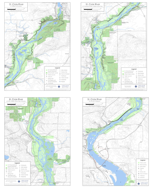
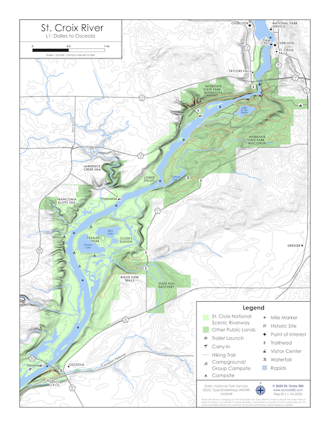
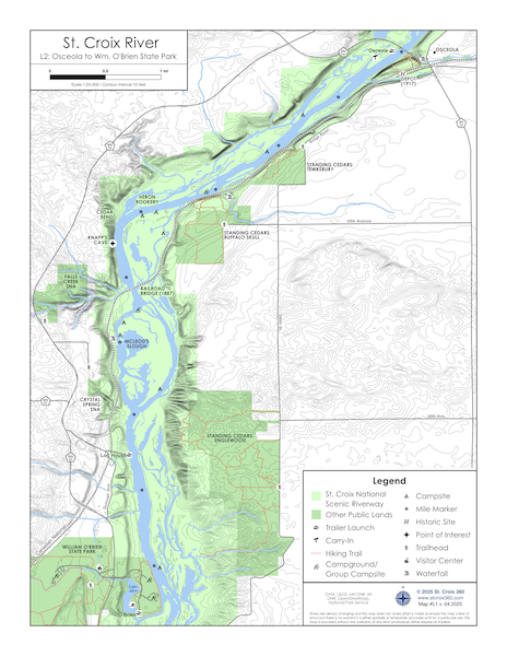
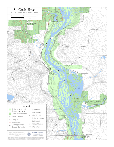
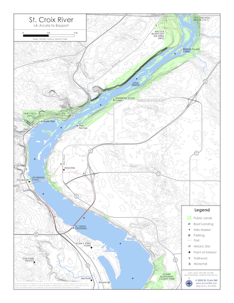

St. Croix 360's river maps are full of information to make your next trip your best trip.
-
- Printed on durable, waterproof synthetic paper
- Topographic lines show elevation contours of the river valley
- Public lands include state parks and nature preserves
-
- Boat landings
- Campgrounds
- Historic sites
- Hiking trails
- Major roads and bridges
- Wildlife sites
-
- Geologic features
- Waterfalls
- Land and water
- Unique places and names