St. Croix 360 River Goods
The St. Croix River Watershed Map (Framed)
The St. Croix River Watershed Map (Framed)
Couldn't load pickup availability
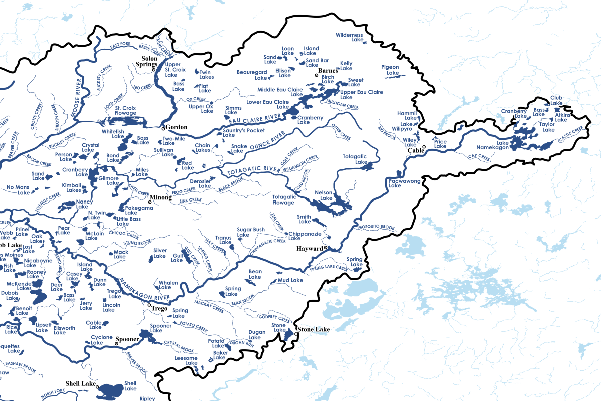
Explore the broad St. Croix River watershed from the comfort of your own home or cabin with this custom map designed by St. Croix 360 founder Greg Seitz.
At 36" wide and 24" tall, it shows an incredible amount of detail for the 7,700-square mile region. Framed in your choice of black, white, or oak.
You will be awed by this huge network of interconnected lakes, rivers, and creeks. It will inspire dreams and spark old memories.
Features:
- 552 labeled lakes
- 165 labeled creeks
- 31 labeled rivers
- 76 labeled cities
- PLUS: An elevation profile showing the St. Croix River's gradient over its length
- ALSO: Key watershed data
Explore the map:
Specifications:
This framed poster is printed on thick matte paper and the frame is made from wood from renewable forests.
- Ayous wood .75″ (1.9 cm) thick frame from renewable forests
- Paper thickness: 10.3 mil (0.26 mm)
- Paper weight: 189 g/m²
- Lightweight
- Acrylite front protector
- Hanging hardware included
- Blank product components in the US sourced from Japan and the US
This product is made especially for you as soon as you place an order, which is why it takes us a bit longer to deliver it to you. Making products on demand instead of in bulk helps reduce overproduction, so thank you for making thoughtful purchasing decisions!